Navionics® Boating
- 48.83K
- 2.8
- Installs
- 5.00M
- Price
- Free
Screenshots
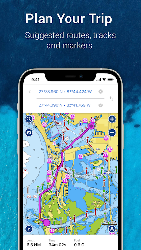
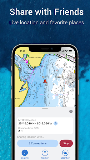
Analysis by Reviewed APKs
Navionics® Boating is a charting and trip-planning app for people who spend time on the water, from anglers checking a lake to boaters preparing a coastal route. I like that it brings offline charts, weather information and saved trip details together in one place. It has a broad feature set, though the subscription model and the need to treat route suggestions as planning aids matter.
Planning a Day Afloat
When I imagine using Navionics® Boating for a typical outing, the useful work starts before the boat leaves the dock. I can study a nautical chart, look at port plans and anchorages, then mark a place I want to visit. The app also offers weather forecasts, tides and currents, so I can check several kinds of trip information in the same planning session rather than jumping between unrelated tools.
Once underway, an offline chart can be handy when a connection is unavailable. I can record a track and save a marker for a promising fishing spot or a useful anchorage, then review those details later. Auto Guidance+ can suggest a dock-to-dock path and show information such as distance and estimated arrival, but the app explicitly frames it as planning support—not a replacement for safe navigation.
More Than a Map App
A basic map app is useful for getting around on land, but Navionics® Boating is built around marine charts and water-specific information. Its chart options include nautical charts, SonarChart HD bathymetry and, in some covered areas, U.S. government charts. Weather, tides, currents and boating community contributions make it more specialized than a general-purpose map, especially when I am planning around a harbor or a fishing area.
That specialization also sets a boundary. This is not a general travel planner or a substitute for a chartplotter, trained judgment or attention to conditions. Some capabilities connect to compatible external equipment, and continuing access to charts and advanced features requires a subscription after the limited free trial. If I only take an occasional short trip and need a simple map, the range of tools may feel like more than I need.
Small Habits, Better Prep
A few small habits make the app’s breadth easier to manage. I would download or check the relevant offline charts before heading out, then review the chart and weather information while I still have a reliable connection. Saving a marker when I find a useful location is more practical than expecting to remember the exact spot later, particularly if I want to return on another outing.
After a trip, a recorded track can help me look back at where I went, while saved routes and markers give the next planning session a starting point. Community edits and ActiveCaptain community information can add local context, and GPX import or export offers a way to move saved data beyond the app. I would still compare suggested routes with the chart and conditions rather than treating an automated path as a final decision.
More From Our News Desk

Zoom Meetings, Google Meet, or Teams: Which Is Easiest to Join?

How I Build a Free Streaming Lineup With Tubi

Why Crunchyroll Is the Default Anime App for So Many Fans
YouTube TV: A Practical Guide to Cutting Cable

Rummikub and the Small Comfort of Phone Games
TeamViewer Remote Control or AnyDesk for Helping Family?
Who Gets the Most From It
I’d recommend Navionics® Boating to boaters, sailors, anglers and other water users who want detailed charts alongside planning tools and saved trip information. It can be especially useful for someone who regularly visits different waterways or likes to prepare routes and review tracks afterward. The combination of offline charts, overlays, markers and local community contributions gives frequent users plenty to explore.
It may be less appealing if you want only a lightweight map or do not plan to pay for continued chart and advanced-feature access after the trial. Some features depend on compatible equipment, and the app’s route-planning tools are not a substitute for safe navigation. I’d also suggest checking the coverage and subscription details for the areas and features you care about before relying on it for regular trips.
Navionics® Boating is developed by Garmin and is available on Google Play for Android devices. It has more than 5 million installs and a 2.8-star rating from about 48,800 ratings. The app is rated Everyone. Its listed version varies with device, and the recorded release date is January 2, 2014.
The app is free to install and includes ads and in-app purchases. The listed in-app product range is $49.99 to $149.99 per item. Its last update is dated October 30, 2026. Chart and advanced-feature access is offered through a yearly auto-renewable subscription after a limited free trial; the subscription can be managed, and auto-renewal can be turned off.
A Closer Look at Life on the Water
Opening the Chart
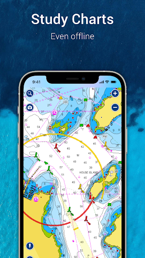
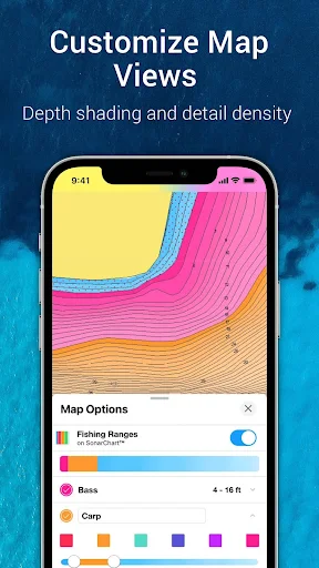
My first impression is that Navionics® Boating is designed for people who want more than a single route line. The chart choices and overlays put the focus on understanding the water, not simply reaching a destination. Nautical charts, bathymetry maps and available government charts give the app a distinctly marine feel, while the options to change chart combinations make it possible to tailor what I’m looking at.
I would start by choosing the waters I plan to visit and checking which chart coverage and features are available for them. The app describes its charts as usable offline, which makes preparation important: I’d make sure the relevant material is ready before setting off. A tablet’s positioning depends on its connectivity and hardware; the description says a Wi-Fi-only tablet can estimate position when connected to Wi-Fi, while a Wi-Fi and 3G model works more like a phone with GPS.
The Everyday Charting
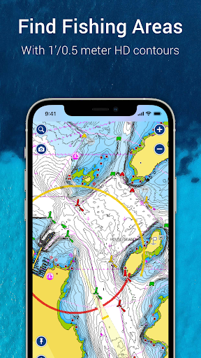
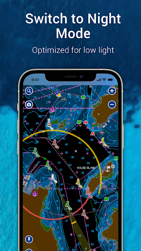
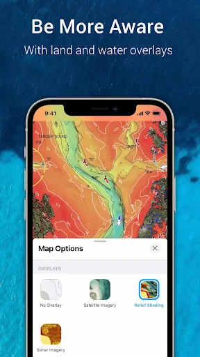
Day to day, the chart is the anchor for the experience. I can look at port plans, anchorages, safety depth contours, navigation aids and marine services, then switch overlays to see different kinds of information. Relief shading helps show bottom topography, while satellite imagery can be displayed on land and water. On select lakes, sonar imagery shows bottom hardness in color, adding a different perspective for anglers.
I appreciate that the app supports a mix of preparation and record-keeping. Markers let me save a point of interest, tracks preserve a route traveled, and distance measurement helps compare two points. The ability to add photos and videos to a record of the day makes the app more useful as a personal log, rather than a chart I open only when I need directions.
Useful Extras for Boaters
Auto Guidance+ is one of the more visible planning tools. It suggests a dock-to-dock path based on chart data and navigation aids, and can provide details such as estimated arrival, distance, heading to a waypoint and fuel consumption. I can see why that would help organize an outing, but I would use the suggestion as a starting point and keep the app’s safety caveat in mind.
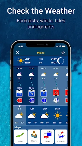
Weather and water conditions add another layer to preparation. The app provides real-time weather data, daily and hourly forecasts, wind information, weather buoys, tides and currents. Community edits and ActiveCaptain contributions can surface points of interest, navigation aids and recommendations from other boaters. Those sources broaden the chart’s context, though local information is best treated as helpful input alongside direct observation.
A Useful Post-Trip Routine
A practical routine could begin the evening before a trip: check the relevant chart, review forecasts and tides, and place markers for intended stops. If I use a suggested route, I’d inspect it against the chart rather than accepting it automatically. This makes the planning tools part of a broader check instead of letting a single screen make the decision for me.
After returning, I could review the recorded track and keep markers for places worth remembering. Sharing routes, tracks and live location can help friends meet on the water or follow an outing. GPX import and export also make saved data easier to transfer or use outside the app. These options are most valuable when I make a habit of saving information as I go, rather than trying to reconstruct it later.
Things to Keep in Mind
The biggest practical limitation is the subscription boundary. The app offers a limited free trial, but continued use of charts and advanced features requires a yearly auto-renewable subscription. The store also lists in-app purchases across a wide price range, so I would check the current purchase details and coverage before building a regular routine around a particular chart or tool.
Some advanced functions require compatible external equipment. Plotter Sync needs a compatible chartplotter, SonarChart Live mapping works with a compatible sonar or plotter, and AIS support needs a compatible Wi-Fi AIS receiver. Those connections can expand what the app does, but they are not universal features that every user can use with a phone alone.
Finally, the app packs in a lot of information, which may be more than a casual boater needs. Charts and route suggestions are useful aids, not guarantees about conditions or a replacement for safe navigation operations. I’d approach the app as a capable planning and reference tool, while continuing to make decisions based on the water, equipment and circumstances in front of me.
Navionics® Boating brings detailed marine charts, offline access, planning tools and trip records into a substantial package. I like its range, especially the way charts, weather and saved markers can support a whole outing rather than just a moment of navigation. The subscription and equipment requirements are real considerations, and route suggestions still need a careful human check.
For regular boaters and anglers who will use its charting depth, I think it is worth exploring during the free trial. For occasional users seeking only a simple map, it may be more app—and more ongoing cost—than necessary. I’d check local coverage and subscription options before making it part of my routine.
Navionics Boating Frequently Asked Questions
What is Navionics® Boating used for?
Navionics® Boating is a marine charting and trip-planning app. It offers nautical charts that can be used offline, chart overlays, weather and water-condition information, route planning, markers and track recording. Boaters can also share routes or location, consult community contributions, and use certain features with compatible external equipment.
What devices can run Navionics® Boating?
Navionics® Boating is available on Android through Google Play. The app description also explains positioning differences for tablets: a Wi-Fi-only tablet uses Wi-Fi to locate an approximate position, while a Wi-Fi and 3G tablet operates similarly to a phone with GPS. Check the store page for current device compatibility.
What Android version does Navionics® Boating require?
The Android version requirement may vary as the app changes, so check the Navionics® Boating Google Play page on your device for the current compatibility details. The listed app version itself varies with device. A tablet’s ability to determine position also depends on its connectivity and hardware.
Does Navionics® Boating cost money?
The app is free to install and offers a limited free trial. Continued use of charts and advanced features requires a yearly auto-renewable subscription, and Google Play lists in-app purchases from $49.99 to $149.99 per item. Purchase details can vary, so check the store page before subscribing.
Is Navionics® Boating a good fit for casual boaters?
It can suit casual boaters who want marine charts, weather and trip-planning tools, but the breadth may be unnecessary if you only need a simple map. Regular users of charts, markers and tracks may get more from it. Some features also need compatible external equipment, and route suggestions are for planning rather than a replacement for safe navigation.
Pros
- Offline marine charts and multiple overlays support detailed trip preparation.
- Weather, tides, currents, markers and tracks bring useful planning tools together.
- Community contributions and GPX sharing add local context and data portability.
- Compatible equipment can extend the app with plotter sync, sonar mapping and AIS.
Cons
- Continued chart and advanced-feature access requires a yearly subscription after the trial.
- Several advanced tools depend on compatible external marine equipment.
- Its many options may feel excessive for occasional users seeking a basic map.
- Category
- Maps & Navigation