Live Earth Map 3D
- 0
- —
- Installs
- —
- Price
- Free

Screenshots
Analysis by Reviewed APKs
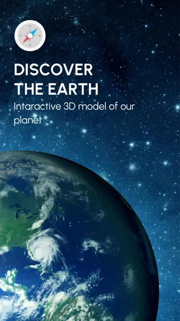
Live Earth Map 3D is an iOS map app for exploring places around the world, from nearby streets to faraway landmarks. I’d point curious travelers, armchair explorers and anyone planning a visit toward it. Its mix of map styles, place descriptions, coordinates, street-level views and 3D buildings gives exploration more texture than a basic map, though I’d treat it as a discovery tool rather than a complete trip-planning solution.
A Little Exploring Before a Trip
When I’m thinking about a place I haven’t visited, I like to get a feel for it before deciding what to look up next. Live Earth Map 3D suits that kind of browsing: I can move around the map, select a point for information, and switch to street view to see streets and neighborhoods more closely. It turns a vague destination into a collection of specific places worth investigating.
I can imagine using it over breakfast before a day out: check the area around a landmark, look at the streets nearby, then note the coordinates of a particular point. The descriptions can add context about landmarks and geography, while a 3D view can make the shape of a city easier to grasp. It’s a hands-on way to explore without turning the whole session into a formal itinerary.
A Map for Browsing, Not Everything
The obvious comparison is a conventional map app. Those are often where people go for practical trip details; Live Earth Map 3D puts more emphasis on looking around and learning about a selected location. Street-level exploration, selectable map styles and descriptions make it appealing when the question is “What does this place look like?” or “What’s interesting here?” rather than simply “How do I get there?”
That distinction matters. The description includes coordinates and navigation-related language, but it doesn’t establish a full set of journey-planning tools. I wouldn’t assume it replaces a dedicated navigation app or provides every detail needed to organize a trip. I’d use it to build a visual impression, explore a landmark’s surroundings and satisfy curiosity, then turn to a more specialized option if I need a particular travel function.
Make Browsing More Useful
A small habit that helps with map exploration is to start with a clear question. I might look for a landmark, compare the surrounding streets, or check a point’s coordinates. That gives each map session a purpose without making it feel like research homework. If I find something interesting, I can use its description as a prompt to explore nearby areas and get a broader sense of the place.
I’d also try changing the map style rather than sticking with the first view. A classic or schematic display may be easier for one kind of scan, while a topographical style can suit a different kind of place. Street view and 3D buildings add another perspective when I want a closer look. Switching views as I go is a practical way to make the map more informative.
More From Our News Desk

Zoom Meetings, Google Meet, or Teams: Which Is Easiest to Join?

How I Build a Free Streaming Lineup With Tubi

Why Crunchyroll Is the Default Anime App for So Many Fans

YouTube TV: A Practical Guide to Cutting Cable

Rummikub and the Small Comfort of Phone Games

TeamViewer Remote Control or AnyDesk for Helping Family?
Who Might Enjoy Exploring
I’d recommend Live Earth Map 3D to people who like exploring destinations visually, whether they’re preparing for a trip or simply curious about the world. It has several ways to inspect a place: map styles, street-level views, 3D structures, coordinates and point descriptions. That combination is useful for someone who enjoys following a landmark or neighborhood down a rabbit hole and learning a little as they move around.
It may be less suitable for someone looking for a narrowly focused navigation tool or a highly structured travel planner. The app’s described strengths are exploration and location information, not a broad set of itinerary or transport services. If you prefer a clean, single-purpose map with no extra visual layers, its choice of displays may also be more than you need. I’d try it if discovery is the point.
Live Earth Map 3D is an iOS app by Artem Chuvilin in the Travel & Local category. It is free to download on the App Store and has a 4+ age rating. The current version in the supplied app information is 3.4. These basics make it easy to identify, though the practical fit depends most on whether you want an exploratory map rather than a more specialized travel tool.
The app requires iOS 16.0 or later. Its release date is August 14, 2023, and its last update date is January 27, 2026. I’d check the App Store entry for current device compatibility and any other details that can change. The supplied information gives no price for in-app purchases, so it’s sensible to review the store page for current cost information before downloading.
A Closer Look at World Exploring
Starting With the Map
My first impression is that Live Earth Map 3D is built around the pleasure of looking around. Rather than being described as a list of travel tasks, it brings together map browsing, place information and more immersive ways to view streets and buildings. That makes it approachable for an unplanned session: pick a point, see what information is available, and decide whether to explore closer.
The feature set gives the experience a few different entry points. I might start with a landmark, a neighborhood or a geographical feature, then use the map’s point descriptions or coordinates to focus on a particular spot. I’d keep the first session simple and try the different views in one area. That makes it easier to see which display helps me understand a place.
Everyday Map Exploring
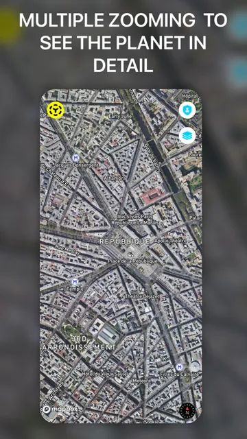
The day-to-day appeal is the ability to move between a broad view and a closer one. I can imagine scanning a city, selecting a point for more information, then switching to street view to look along a road or through a neighborhood. That change in scale gives a casual browsing session some direction without requiring a long checklist or a planned route.
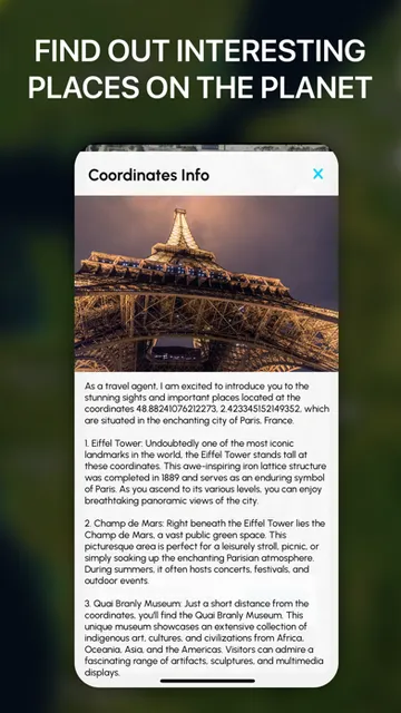
Coordinates are a useful addition when I want to identify a specific point rather than just admire a view. The app’s description says selected points can show geographic coordinates, as well as information about landmarks and geographical features. Together, these details make the map more than a backdrop: they give me something concrete to follow up on when a place catches my attention.
Views With Different Uses
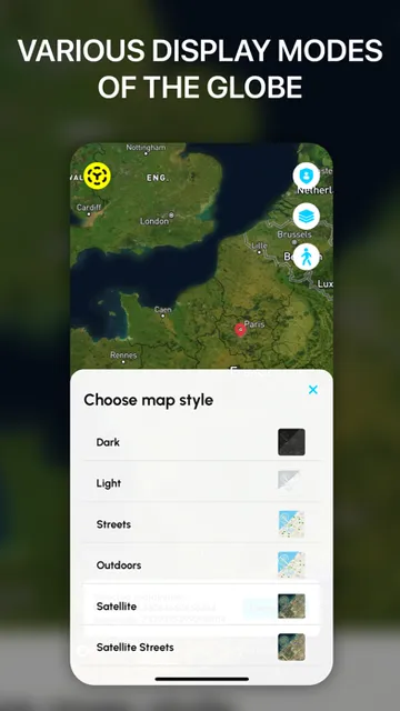
The choice of map styles is one of the more practical touches. Classic, schematic and topographical displays offer different ways of looking at the same surroundings, and themed styles add another option. I’d switch between them based on what I’m trying to notice rather than expecting one style to be best for every location. It gives browsing a little flexibility without changing the basic task.
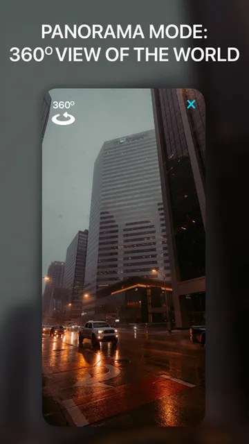
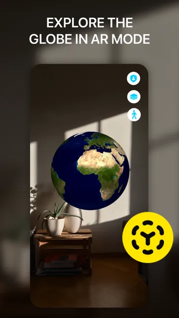
Street view and 3D buildings provide a more visual way to inspect a location. In street view, the description says users can zoom, turn and navigate through streets and neighborhoods. Buildings shown in three dimensions can help give a city or landmark more shape than a flat map does. These options are especially appealing when I want to picture a place rather than only locate it.
A Simple Exploration Routine
For a low-effort routine, I’d pick one destination and explore it in stages. First I’d look at the general area, then select a landmark or geographical point for its description and coordinates. After that, I’d switch to street view to see the surrounding streets. It’s an easy sequence to remember, and each step adds a different kind of information without needing to plan a whole day.
I’d use the routine for places I’m curious about as much as places I might visit. A short session could begin with a well-known landmark and end with a look at nearby neighborhoods or streets. Changing map styles along the way gives me another way to compare the same area. The point isn’t to collect every detail; it’s to build a clearer visual sense of somewhere new.
Keep Its Role in Mind
The main limit is that a rich map view and point information don’t automatically make a complete travel service. The app’s described features focus on exploring locations, viewing coordinates, reading descriptions and looking around in street view. If I need a specific type of route planning or a particular travel detail, I wouldn’t assume it is available just because the app describes navigation and exploration.
I’d also keep expectations grounded about what a map can tell me. A 3D building view and a street-level look can help me picture an area, but they are still ways of viewing a place, not a substitute for being there. For casual discovery, that’s part of the fun. For a practical trip, I’d use the app as one source of context and check any other details I need separately.
Live Earth Map 3D is at its best when I want to wander around a place on screen, switch perspectives and learn a little about a selected point. The combination of street view, 3D buildings, coordinates and map styles gives exploration more variety than a simple overhead look.
I’d recommend it to curious travelers and visual explorers who want a map for browsing destinations. If your priority is a dedicated navigation or itinerary tool, it may not be the right fit on its own. For learning the shape and feel of a place before or between trips, it offers a useful, approachable starting point.
Live Earth Map 3D Frequently Asked Questions
What is Live Earth Map 3D used for?
Live Earth Map 3D is for exploring locations around the world. Its described features include selectable-point descriptions and coordinates, street-level exploration, different map styles and 3D buildings. I’d use it to get a visual sense of a landmark or neighborhood and learn more about a selected point, rather than assume it covers every travel-planning need.
Which devices can run Live Earth Map 3D?
Live Earth Map 3D is an iOS app and requires iOS 16.0 or later. Check the App Store entry for current compatibility with a particular device, since supported devices and requirements can change. The supplied information identifies the iOS platform; it doesn’t describe an Android or desktop version.
Does Live Earth Map 3D cost money?
The app is listed as free to download on the App Store. The supplied information doesn’t give a price for in-app purchases, so check the current store entry for details that may vary. That’s the best place to review the latest cost information before installing it.
What iOS version does Live Earth Map 3D require?
Live Earth Map 3D requires iOS 16.0 or later. If you’re unsure whether your device meets that requirement, check its software version and the current App Store entry. Store information is also worth checking for any changes to compatibility since the app details were last updated.
Who is Live Earth Map 3D best suited to?
I’d suggest it to people who enjoy exploring places visually, browsing streets and landmarks, or comparing map views. It may be less suited to someone who wants only a narrowly focused navigation or itinerary app. Its described strengths are location exploration, point information, coordinates, street view and 3D buildings.
Pros
- Combines point descriptions and coordinates with visual map exploration.
- Street view offers a closer look at streets and neighborhoods.
- Multiple map styles and 3D buildings add viewing options.
- Free to download on the App Store.
Cons
- Its described features focus on exploration rather than a full travel-planning toolkit.
- Requires iOS 16.0 or later.
- In-app purchase details may vary; check the App Store entry.
- Category
- Travel & Local
- Version
- 3.4