onX Hunt: Offline Hunting Maps
- 64.29K
- 4.6
- Installs
- 5.00M
- Price
- Free

Screenshots
Analysis by Reviewed APKs
onX Hunt: Offline Hunting Maps is a field and planning tool for hunters who want terrain, property boundaries, and navigation in one place. I found its strongest appeal in preparing before a trip and keeping useful map details available outdoors, including when offline maps are needed. It has a lot to explore, so it suits people who enjoy doing some homework before heading out.
Planning a Day in the Field
When I picture using onX Hunt for a day out, I start at home by looking over a topo or satellite map and checking the boundaries around a promising area. Property lines and public-land layers help put the route in context, while hunting units can clarify which designated area I’m viewing. I can mark useful spots with Waypoints, sketch routes, and save a map for offline use before leaving service behind.
That preparation matters most when a hunt involves unfamiliar ground. I can use terrain views to think through access and distances, then rely on the phone’s GPS navigation in the field. Weather and wind conditions can be checked at Waypoints, and the app can log a hunt’s duration, distance, and speed. It’s a practical combination: plan with more detail at home, then keep key information close when walking.
A Map Tool, Not a Guide
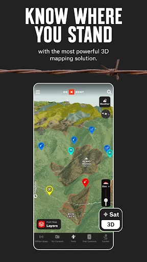
Compared with a general-purpose map app, onX Hunt is built around hunting-specific information: land boundaries, hunting units, wildlife and habitat layers, and tools for marking locations. Its 2D and 3D views, topo data, and satellite imagery give me different ways to read the same landscape. The point is not just to get from one place to another; it’s to prepare for a hunt with relevant map context.
It is not a substitute for field judgment or a promise that a particular spot will produce game. Nor is it aimed at someone who only needs basic directions for errands or a casual walk. Some features depend on a membership, and landowner information is for the U.S. and may not cover every county. I’d treat the map as a planning aid and check the ground around me as I go.
Small Habits That Help
A useful habit is to save the area I expect to visit before the trip, with the layers and Markups I care about included. That way, the offline map is more than a bare background when I’m away from a connection. I’d also add Waypoints as I plan, rather than trying to remember every access point or location later. Clear labels make those saved notes easier to use in the field.
I’d check weather and set wind conditions at relevant Waypoints as part of the same planning session. After a trip, the hunt log can help me review duration, distance, and speed. If I use compatible gear, integrations with trail cameras, rangefinders, binoculars, Android Auto, or Wear OS may fit into the routine. I would start with the tools I already use rather than trying to configure everything at once.
More From Our News Desk

Zoom Meetings, Google Meet, or Teams: Which Is Easiest to Join?

How I Build a Free Streaming Lineup With Tubi

Why Crunchyroll Is the Default Anime App for So Many Fans

YouTube TV: A Practical Guide to Cutting Cable

Rummikub and the Small Comfort of Phone Games
TeamViewer Remote Control or AnyDesk for Helping Family?
Who May Find It Useful
I’d recommend onX Hunt to hunters who regularly plan trips on public or private land and want boundaries, terrain, and hunting-specific layers together. It is especially relevant if you travel beyond reliable cell service, since saved Offline Maps are part of the toolkit. People who like to study an area at home, mark locations, and arrive with a plan should find the range of map details useful.
It may feel like more app than needed for someone who only wants basic navigation or rarely hunts. The number of layers and membership options can also take time to sort through, and some mapping coverage has geographic limits. If you prefer a simple map with few decisions to make, a general navigation app may be a more comfortable fit. onX Hunt makes most sense when its hunting-specific information matters to your routine.
onX Hunt: Offline Hunting Maps is a free Android app from onXmaps. Google Play shows over 5 million installs and a 4.6-star rating from about 64,000 ratings. The content rating is Everyone. The app is available for devices running Android 8.0 or later.
The app is free to install and contains no ads, with in-app purchases priced from $9.99 to $99.99 per item. It was released on November 8, 2013, and was last updated on February 2, 2026. The current version can vary by device, so it is worth checking Google Play for the version available to you.
A Closer Look at the Field Workflow
Getting Oriented
My first impression is that onX Hunt is a map app with a clear job, but a fairly broad toolset. Topographic, satellite, and hybrid basemaps offer different starting points, and 2D or 3D views help make terrain easier to interpret. I’d begin by choosing a familiar area and toggling only a couple of relevant layers rather than trying to understand every option at once.
The app also includes online Desktop Maps for scouting from home. That makes the transition from research to phone-based field use feel natural: plan on a larger screen if that suits you, then keep the map and marked locations handy on your Android device. I’d make sure to save any areas I expect to need offline before setting out.
Using It Day to Day
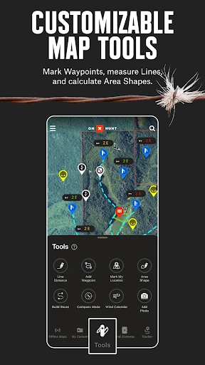
In everyday use, the value is having map context and navigation together. I can check land boundaries, look at terrain, and use GPS navigation without switching between separate tools for every step. Markups and Waypoints give the map a personal layer of notes, while line-distance and area-shape tools help me think through routes or the scale of a spot I’m considering.
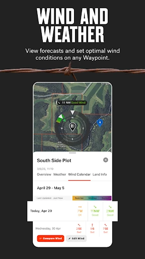
The hunt tracker adds a record of duration, distance, and speed. I like that this is tied to the same activity rather than being an unrelated fitness feature. Weather and wind conditions can be monitored at Waypoints, which keeps those checks connected to specific places. The app’s usefulness depends on how much of this information I actually use, so a focused setup seems best.
Layers Beyond the Basics
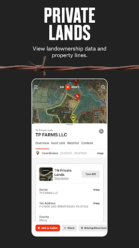
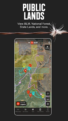
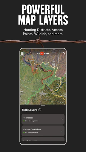
The hunting-specific layers are what separate this from a standard map in a meaningful way. Depending on the area and membership, the app can show public and private land boundaries, landowner names in the U.S., hunting units, and public-land sources such as Forest Service and BLM maps. Species-related layers cover deer, elk, turkey, and waterfowl, with additional wildlife, tree, crop, and soil data available as map layers.
A few other tools broaden the picture. There is a Historic Wildfire Layer for finding areas with nutrient-rich soil, and the app offers lidar topo alongside satellite and hybrid views. Membership descriptions also include features such as recent imagery, a route builder, and a deer movement forecast for Elite Nationwide members. I’d check the plan details before assuming a specific layer is included.
A Pre-Trip Routine
For a practical routine, I’d choose the area first, inspect its boundaries and terrain, then mark a few places worth remembering. I’d use the distance and area tools to get a better feel for the scale of the plan, check wind and weather at key Waypoints, and save the map with the layers and Markups I want available offline. This turns a collection of features into a useful preparation checklist.
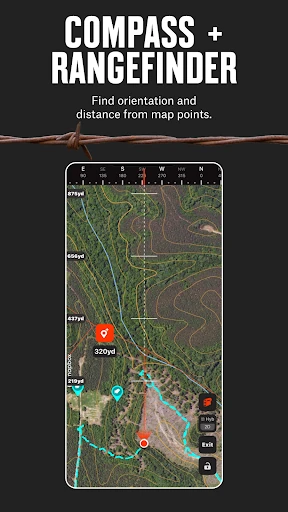
In the field, I’d keep the map open for navigation and add a Waypoint when something deserves a note for later. If compatible trail cameras are connected, the app can show images and insights; compatible rangefinders and binoculars can sync to create Waypoints. Afterward, the hunt log offers a simple way to review how long and how far I went.
Limits to Keep in Mind
The biggest practical limitation is that coverage and features are not identical everywhere. Private-land ownership maps are U.S.-only and may not be available in every county. Some tools are part of paid memberships, and the plans differ in geographic coverage: Premium covers a state or Canada, Premium+ covers two states or one state plus Canada, and Elite Nationwide covers the listed nationwide areas and added features.
I’d also avoid treating any map as a complete substitute for what I see on the ground. A dense set of layers can make the screen busy, so it takes a little restraint to keep the view readable. Offline access requires saving maps ahead of time, which is easy to overlook when trip preparation gets rushed. For the best experience, I’d test my chosen setup before relying on it in a remote area.
onX Hunt earns its place as a specialized planning and navigation app, particularly for hunters who need more than roads and basic directions. The mix of boundaries, terrain, custom Markups, Waypoints, and offline maps can support a thoughtful trip from the first look at home through time in the field.
I’d suggest trying it if hunting maps and offline preparation are part of your routine, and beginning with the features you need most. It is less compelling for someone seeking a bare-bones navigation app. Check which membership and map coverage fit your area before building a workflow around paid features.
onX Hunt Frequently Asked Questions
What is onX Hunt used for?
onX Hunt is a hunting map and navigation app for planning trips and using map information in the field. It includes terrain and satellite maps, land boundaries, hunting units, Waypoints, Markups, GPS navigation, and Offline Maps. It can also track a hunt’s duration, distance, and speed, with weather and wind information available at Waypoints.
Can I use onX Hunt on Android, and what devices does it need?
The app is available on Android and requires Android 8.0 or later. Google Play is the place to check for device compatibility and the version currently available for your phone. The description also mentions Wear OS and Android Auto integrations, along with compatible rangefinders, binoculars, and trail cameras.
How much does onX Hunt cost?
onX Hunt is free to install and has in-app purchases priced from $9.99 to $99.99 per item. The description offers a free trial when you install the app and select a state, and it outlines Premium, Premium+, and Elite Nationwide memberships. Check Google Play for current purchase details and which features each option includes.
Does onX Hunt work without cell service?
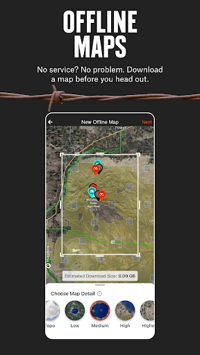
The app lets you save Offline Maps, including layers, custom Markups, and Waypoints, for use in the field. You’ll need to save the area before you lose your connection. Coverage and available map information can vary by location, so it is sensible to prepare and review the relevant map before a trip.
Who is onX Hunt best suited for?
It is best suited to hunters who want hunting-specific maps, land boundaries, planning tools, and GPS navigation in one app. People who routinely scout areas or need offline maps may get more from it than someone looking only for simple directions. Some features require a membership, and landowner information is limited to the U.S. and may vary by county.
Pros
- Combines hunting maps, terrain views, land boundaries, and GPS navigation.
- Offline Maps can include selected layers, Markups, and Waypoints.
- Planning tools cover weather, wind, distance, area, and hunt tracking.
- Supports integrations with select trail cameras and compatible field gear.
Cons
- Some features require a paid membership with different coverage options.
- Private-land ownership maps may not be available in every U.S. county.
- The range of layers and tools may feel busy to casual map users.
- Category
- Sports
- Version
- VARY